At a glance
- Original Downtown
- Jung-gu, Seo-gu, Dong-gu, Yeongdo-gu — Nampo-dong, Jagalchi, Busan Station, Taejongdae
- Seomyeon
- Busanjin-gu — where Metro Lines 1 and 2 cross; the most practical base
- Dongnae
- Dongnae-gu, Geumjeong-gu, Yeonje-gu — the old walled town, hot springs, Beomeosa
- East Busan
- Haeundae-gu, Suyeong-gu, Nam-gu, Gijang-gun — the beaches, Centum City, Oryukdo, Yonggungsa
- West Busan
- Saha-gu, Sasang-gu, Buk-gu, Gangseo-gu — Gamcheon, Dadaepo, the Nakdong estuary, the airport
- Whose map
- Our grouping for visitors, built on the city's own split into a central area, East Busan and West Busan
Why two areas isn't quite enough
Most first-timer guides, including some of ours, simplify Busan into the old city (Nampo-dong, Jagalchi) and the beach side (Haeundae, Gwangalli). It's a fair split for two days. But it leaves out the north of the city, where Busan's history actually starts, and the west, where Gamcheon, Dadaepo and the airport are — and it doesn't explain why Seomyeon, which is neither old city nor beach, is where so many visitors end up staying.
The five areas below are our grouping, not an official one, but they follow the city's own plan. According to the Busan History and Culture Encyclopedia, Busan's long-term city plan has two city centers — the original downtown and Seomyeon — and divides the city into three zones: a central area, East Busan (Suyeong-gu, Haeundae-gu and Gijang-gun) and West Busan (Saha-gu, Sasang-gu, Buk-gu and Gangseo-gu). We split the central area into three parts that feel very different on the ground, and moved Nam-gu, with Oryukdo and Igidae, to the east side, where a visitor would actually go for it.
1. Original Downtown — Jung-gu, Seo-gu, Dong-gu, Yeongdo-gu
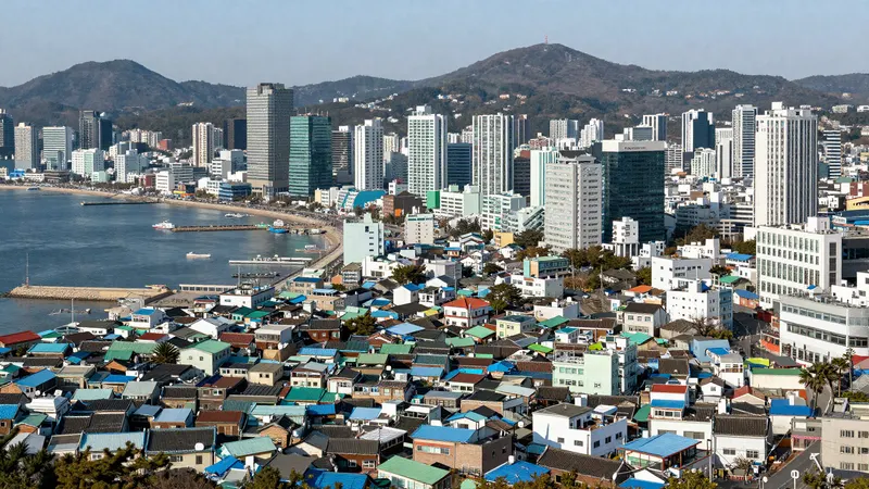
This is the old port city and the area most first-time itineraries already cover: Jagalchi Market, Gukje Market, BIFF Square and Nampo-dong in Jung-gu, with Busan Station in Dong-gu just north. Across the bridge, Yeongdo adds the cliffs of Taejongdae, the Huinnyeoul Culture Village and ARTE Museum. Seo-gu runs west along the shore to Songdo Beach and its cable car.
In the city plan it's one of the two centers, specialized in international trade, business and distribution. For a visitor, it's the area with the most visible history and the best markets, served by Metro Line 1.
2. Seomyeon — Busanjin-gu
Seomyeon is the city's other center: the plan gives it administration, finance, commerce and culture. In practice it's a dense shopping and eating district built around Seomyeon Station, the one place where Metro Lines 1 and 2 cross. That makes it the most practical single base if you plan to move between the old city and the beaches rather than settle into one — the where to stay guide compares it with the alternatives.
It's also the home of one of Busan's best-known clusters of dwaeji gukbap restaurants, and the shopping guide covers its underground arcades and department store.
3. Dongnae — Dongnae-gu, Geumjeong-gu, Yeonje-gu
Dongnae was the administrative center of this coast long before the port city existed. According to Dongnae-gu, the walled town of Dongnae was first built in 1021, during the Goryeo dynasty, to fend off Japanese pirates, and moved to its present site around today's Dongnae Market in 1387. In April 1592 it was the first battlefield of the Imjin War, when Japanese forces landed in Busan, and in 1731 it was rebuilt much larger, with walls about 3.8 km around. Most of the walls were pulled down in the colonial period; parts have been restored since 1979, and the free Dongnae Eupseong History Museum (09:00–18:00, closed Mondays) tells the story.
The rest of the area is the north end of Metro Line 1: Oncheonjang, the old hot-spring district that Visit Busan also lists among the city's grilled hagfish alleys (grilled eel guide); Beomeosa, one of Korea's major mountain temples, in Geumjeong-gu; and the trails of Geumjeongsan National Park above it. Sajik Baseball Stadium, home of the Lotte Giants, is here too, and Yeonje-gu holds Busan City Hall. The city plan makes Dongnae a sub-center for tourism and leisure.
4. East Busan — Haeundae-gu, Suyeong-gu, Nam-gu, Gijang-gun
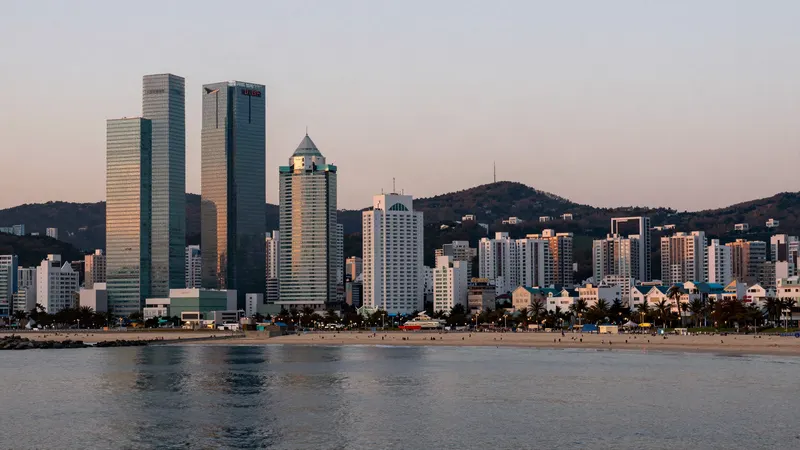
This is most of what people picture when they think of Busan: Haeundae Beach and the LCT tower, whose X the Sky observatory sits on floors 98 to 100; Gwangalli and the Gwangan Bridge in Suyeong-gu; and Centum City, with BEXCO, the Busan Cinema Center and Spa Land. The city plan aims East Busan at information and tourism.
Nam-gu, between Seomyeon and Gwangalli, is where Oryukdo Skywalk, the Igidae coastal trail and the UN Memorial Cemetery are. Further up the coast, Gijang-gun has Songjeong Beach, Haedong Yonggungsa and the fishing villages known for grilled hagfish and conger eel.
The trade-off: the east is the far side of the city from Gimhae Airport and the old downtown, so basing yourself here works best if beach time matters more than being central.
5. West Busan — Saha-gu, Sasang-gu, Buk-gu, Gangseo-gu
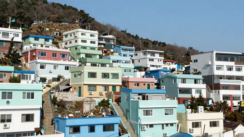
The west is more residential and industrial — the city plan gives it production and logistics — and most visitors only pass through, since Gimhae Airport is in Gangseo-gu and the airport light rail runs through Sasang. But two of the city's best-known sights are in Saha-gu: Gamcheon Culture Village on its hillside, and Dadaepo Beach, with its sunset fountain, at the end of Metro Line 1.
The mouth of the Nakdong River, where it meets the sea, is a national natural monument, designated in 1966 as a sanctuary for migratory birds and spread across Gangseo-gu, Sasang-gu and Saha-gu. The national heritage service describes it as one of Korea's largest migratory bird sites, on the flyway linking Japan, Korea and Russia, with winter birds arriving every year from November to March.
Which area for what
| Area | Best known for | Metro |
|---|---|---|
| Original Downtown | Markets, Nampo-dong, Busan Station, Yeongdo's cliffs | Line 1 |
| Seomyeon | Shopping, food, the most central base | Lines 1 and 2 |
| Dongnae | The old walled town, hot springs, Beomeosa, Geumjeongsan | Line 1 (north), Line 4 |
| East Busan | Beaches, Centum City, Oryukdo, Gijang's coast | Line 2, Donghae Line |
| West Busan | Gamcheon, Dadaepo, the Nakdong estuary, the airport | Line 1 (south), Busan–Gimhae Light Rail |
Frequently asked questions
What are Busan's main areas?
We group Busan's 16 districts into five areas: the Original Downtown (Jung-gu, Seo-gu, Dong-gu, Yeongdo-gu), Seomyeon (Busanjin-gu), Dongnae (Dongnae-gu, Geumjeong-gu, Yeonje-gu), East Busan (Haeundae-gu, Suyeong-gu, Nam-gu, Gijang-gun) and West Busan (Saha-gu, Sasang-gu, Buk-gu, Gangseo-gu). It follows the city plan's split into a central area, East Busan and West Busan.
Which area of Busan is the best base?
Seomyeon is the most practical single base, because it's the only place where Metro Lines 1 and 2 cross. Nampo-dong suits a trip focused on the old city, and Haeundae suits one built around the beaches.
Is Dongnae worth visiting?
If you have more than two days. It's the oldest part of the city — the walled town dates from 1021 and was the first battlefield of the Imjin War in 1592 — and the free Dongnae Eupseong History Museum tells that story. Beomeosa Temple, the Oncheonjang hot-spring district and Geumjeongsan are all on the north end of Metro Line 1.
What is there to see in West Busan?
Gamcheon Culture Village and Dadaepo Beach, both in Saha-gu, and the Nakdong River estuary, a national natural monument for migratory birds, best from November to March. Gimhae Airport is in Gangseo-gu.
Which district are Haeundae and Gwangalli in?
Haeundae Beach and Centum City are in Haeundae-gu, and Gwangalli Beach is in Suyeong-gu. Both are on Metro Line 2.